Dive Emerald Bay
While all of the dives in Emerald Bay are only accessible by boat (or a LONG walk with all your gear), there are numerous opportunities to dive from shore around the bay. Personally, I canoe over from Kiva Beach, park on shore, and dive from there.
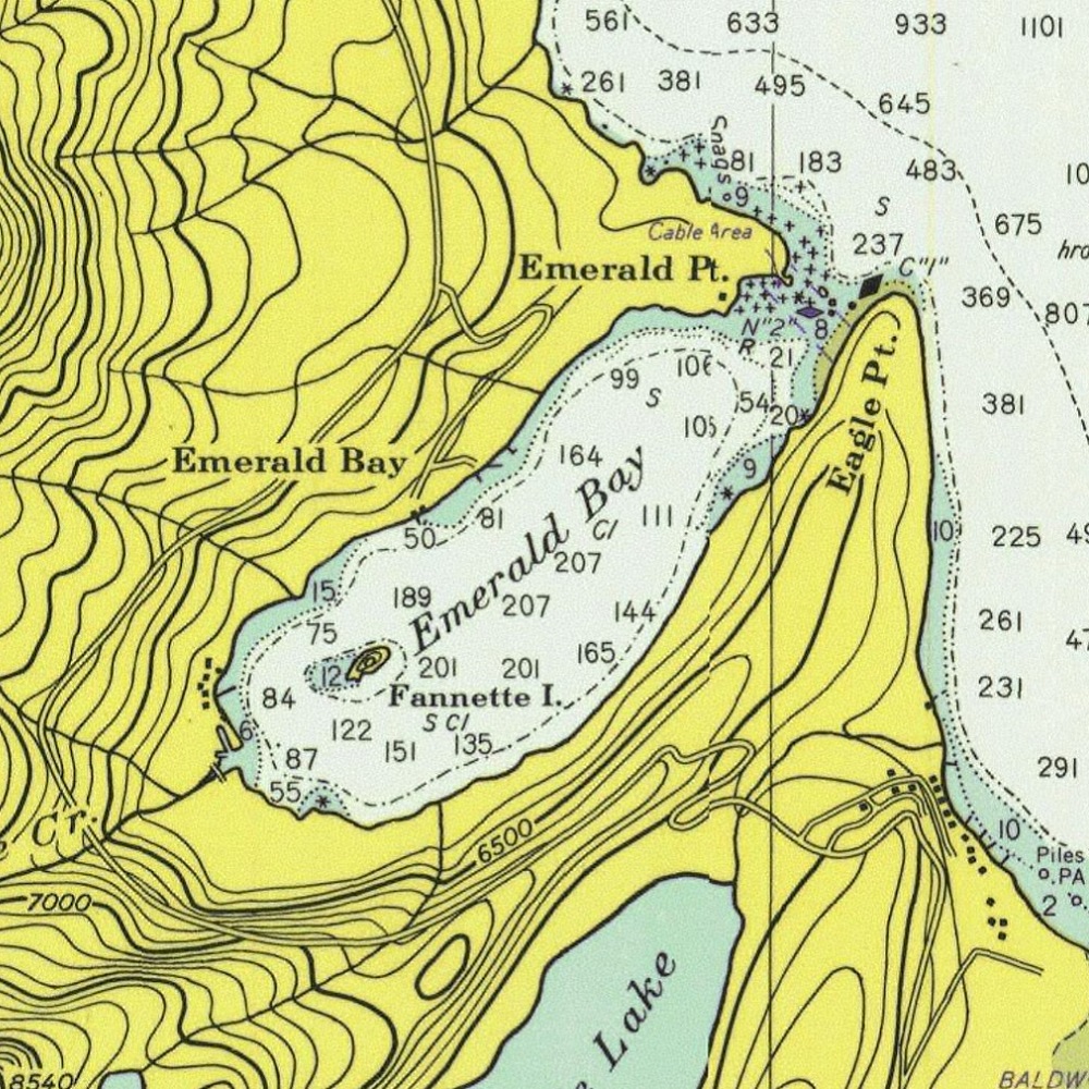
During the warmer months, the bay is absolutely swarming with boats, so exercise caution and at the very least be sure to bring a DSMB. Emerald Bay is an extremely popular boating spot for good reason: it’s spectacular. The bay gets its name from the emerald green water, and it’s even got an island with the shell of an old tea house cabin on top.
If “emerald green water” didn’t give it away, the vis here is worse than elsewhere around the lake, which means it’s also colder and darker as you go deeper. Underwater, you’ll find the Emerald Bay Maritime Heritage Trail. There are five wrecks at four sites around the bay:
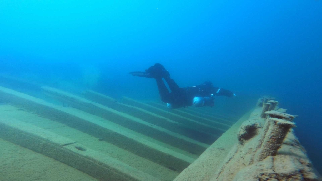
- The wooden barges are by far the largest and easiest to find of the wrecks. Not only can the smaller barge be seen from the surface, but there’s also a mooring buoy marked FOR DIVERS USE ONLY that you’ll likely find a non-diver boat moored to. The barges site between 10 and 50 feet. They’re a monstrous 85 and 106 feet long.
- The Florence M. passenger launch comes in at number three, size-wise, at 27 feet long. It sits at around 60 feet down and as such is a bit harder to find than the barges. If you see the biggest sunken tree in the entire lake, you’re on the right track. Keep heading down the hill.
- The wooden fishing boat ekes out fourth place at 15.5 feet long. It sits in about 35 feet of water. I haven’t been to this one yet, so no insider tips.
- The hard chine skiff is six inches shorter than the wooden fishing boat, but it has a cooler name. It’s around 60 feet down and pretty close to the barges. I haven’t been to this one, either.
The wrecks all have bright white information panels down with them, but if you’re the first one down there in a while, these will be covered in silt and algae and won’t be quite the beacon they are otherwise. The Parks & Rec folks made these cool cards to go along with the wrecks. The GPS coordinates on the cards are in a weird format, but I was able to find an old PDF (currently removed from their site) with the conversions, which is where the coordinates above are from.


Fast facts
- Access: Boat, shore dives available around the bay but only accessible by boat, open year round if you can get there
- Surface swim: Varies with dive
- Parking: Varies with where you put in
- Crowds: Low in winter to very high in summer
- Dive experience level: Beginner to advanced
- Highlights: Marine Heritage Trail, sunken barges